
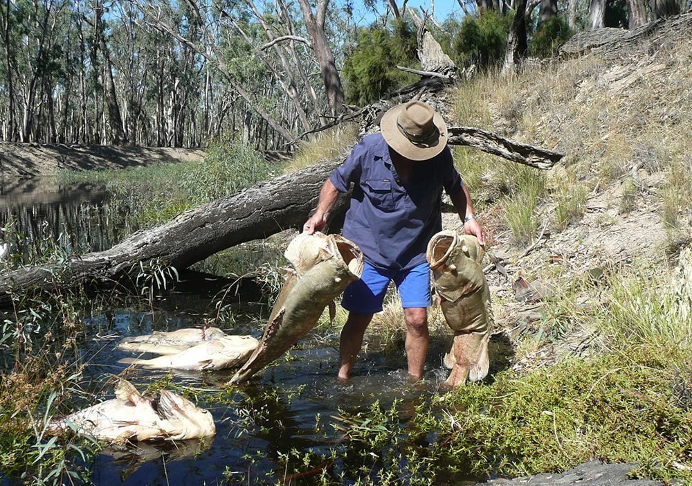
To enable better management of native fish, information about fish, and the activities and events that influence fish populations, needs to be readily available to managers, scientists and community groups responsible for native fish conservation and management. This project aimed to highlight issues relating to water quality (WQ) and fish populations.
The projects main objectives were to:
- collate data, identify and map regions , landscapes, land uses and industries that are important causes of WQ problems in the Basin.
- determine a meaningful scale/accuracy for reporting based on available data and quantitatively report on land use (distributed and point source) contributions to WQ problems on a third order catchment basis.
The methodology devised for the project was designed to:
- facilitate ease of access and use of a complex array of land use and WQ related datasets.
- display the data so that it can be used by managers planning for native fish and their habitat management
- recognise important WQ parameters for native fish in the Basin
- provide insight into areas of the Basin under threat from WQ changes with respect to native fish, and
- provide a predictive yet easy to understand and use spatial model.
The project was a desktop review and Geographic Information System data atlas formation exercise that included: developing a classification of land uses/management practices in relation to WQ impacts; identifying existing relevant datasets and projects; evaluating available data for relevance and identify gaps; reporting the findings for a pilot catchment (the Broken River/Creek catchment in Victoria).
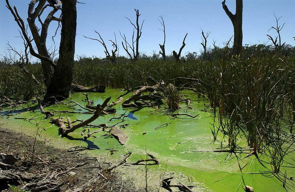
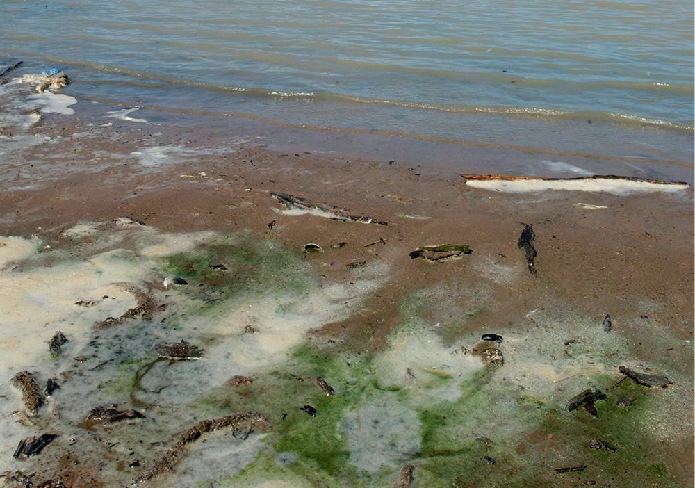
There is a wide range of physical, chemical ecotoxicological and ecological parameters that can be used to provide information on WQ. The WQ parameters selected for the study were considered to have direct effects on native fish, as well as direct effects on habitat suitability, food sources, fish behaviour and ability to migrate and reproduce. Water quality parameters considered of major importance in the study were temperature (cold water); turbidity, dissolved oxygen, and nitrogen/ammonia. Parameters of moderate importance were salinity, pH, toxicants, and pathogens.
There is a direct relationship between land use activities (e.g. mining and acid water drainage) and WQ changes. Similarly there are known relationships between point source discharges from particular industries and WQ. A matrix of relationships between land use/point source discharges and nine WQ parameters informed the development of a spatial model. This model also included a risk assessment of the likelihood and consequence of a critical WQ impact occurring, including the location of high priority native fish sites (species/habitats/refuges).
Findings:
The spatial model when applied to the Broken River catchment mapped land use at a ≤1:100,000 scale. The model clearly identified spatial areas that were at risk of WQ impacts, as well as identifying the level of the risk involved (low, moderate, high extreme). When compared with land use mapped at the 1:250,000 scale, the coarser scale of mapping led to errors in assessment of risk of WQ impacts. Consequently, the spatial model was not recommended to be used for specific catchment investigations where land use was captured at scales >1:100,000.
While the limitations of 1:250,00 scale land use capture are acknowledged, anlysis using such data may provide useful information to focus further investigations. Consequently the spatial model was applied across the entire Basin at the 1:250,000 scale and indicated the following catchments had the most land use area with with high potential to cause water quality impacts that may affect native fish:
- Gwydir
- Namoi
- Murray Hume to SA Border
- Murrumbidgee
- Loddon
- Broken
- Goulburn
- Campaspe
Management implications:
The spatial model provided a useful tool for managers to investigate and visualise areas at risk of WQ impacts to native fish. The ability of the model to discriminate such areas at risk at a specific catchment scale declined above scales of 1:100,000 for land use mapping. The lack of detailed information on fish tolerances to various WQ parameters hampers the precision of the model. Similarly the scarcity of spatial data on WQ and the lack of readily available spatial data for fish distribution was a significant issue.
Read the full report here: Earth Tech (2003). Murray-Darling Native Fish Strategy – Audit of Water Quality Problems. Final report to Murray-Darling Basin Commission


